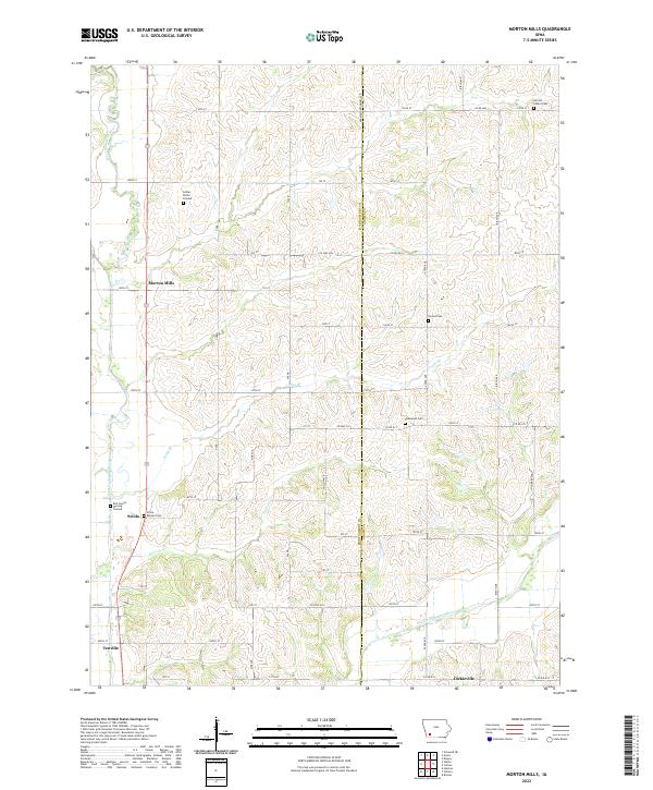
2022 Map of Morton Mills
USGS Topo · Published 2022About this map
The West Nodaway River and Middle Nodaway River carve through this agricultural landscape along the border of Montgomery and Adams counties. This contemporary survey documents the rural character of southwestern Iowa, where small crossroad settlements like Morton Mills, Tenville, and Dickieville persist as anchors for the surrounding farming community. The landscape is notably dense with localized burial sites, ranging from the Indian Burial Ground in the north to family-specific locations like the Bolt Family Burying Ground near the western margin.
Find a feature on this map
49 named features on this map. Tap any name to fly to it.
Don’t see what you’re looking for? This feature index may not catch every label — zoom into the map to look around manually.
Map Details
Editions of this 2022 Morton Mills Map
This is the sole edition of this map. No revisions or reprints were ever made.
Other maps of this area

1954 · Omaha
USGS Topo · 1:250,000

1955 · Nebraska City
USGS Topo · 1:250,000

1957 · Nebraska City
USGS Topo · 1:250,000

1957 · Omaha
USGS Topo · 1:250,000

1958 · Omaha
USGS Topo · 1:250,000

1958 · Nebraska City
USGS Topo · 1:250,000

1978 · Stanton
USGS Topo · 1:24,000

1978 · Wallin
USGS Topo · 1:24,000

1978 · Griswold NE
USGS Topo · 1:24,000

1980 · Grant
USGS Topo · 1:24,000