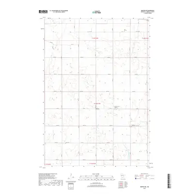
2019 Map of Morton NE
USGS Topo · Published 2019About this map
Agricultural patterns and a network of rural burial grounds define this portion of Renville County. The landscape is marked by the course of Fort Ridgely Cr, which meanders through the central sections, while managed water systems like Ditch Number Twelve and County Ditch Number One Hundred Fifteen indicate the long-term transformation of the prairie for farming. This area preserves a significant genealogical record through its numerous faith-based sites, reflecting the heritage of early settlers. Notable locations include the Palmyra Covenant Swedish Mission Cem and Swetlanda Lutheran Cem, alongside the Saint Paul Cem and Evangelical Lutheran Cem. The strictly organized road grid, including Co Hwy 16 and Co Rd 4, underscores the township and range survey system that shaped this region's development.
Find a feature on this map
38 named features on this map. Tap any name to fly to it.
Don’t see what you’re looking for? This feature index may not catch every label — zoom into the map to look around manually.
Map Details
Editions of this 2019 Morton NE Map
This is the sole edition of this map. No revisions or reprints were ever made.
Other maps of this area

1952 · Morton
USGS Topo · 1:62,500

1953 · New Ulm
USGS Topo · 1:250,000

1957 · New Ulm
USGS Topo · 1:250,000

1957 · Olivia
USGS Topo · 1:62,500

1958 · New Ulm
USGS Topo · 1:250,000

1964 · Fairfax
USGS Topo · 1:24,000

1964 · Hector
USGS Topo · 1:24,000

1967 · New Ulm
USGS Topo · 1:250,000

1967 · Churchill
USGS Topo · 1:24,000
1982 · Olivia SE
USGS Topo · 1:24,000