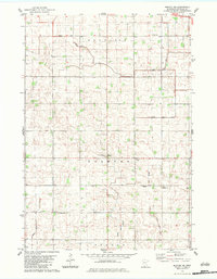
1983 Map of Morton NE
USGS Topo · Published 1983About this map
Palmyra and Melville townships define this agricultural landscape in Renville County, where the regular geometry of section lines is punctuated by a network of drainage infrastructure including Judicial Ditch No 15 and County Ditch No 106A. These engineered waterways reflect the intensive land management required to sustain farming across the prairie. The map identifies several key community anchors, notably the Palmyra American Townhall Ch and Swedlanda Ch, which alongside St Paul Cem and Palmyra Cem, provide vital geographic markers for genealogists and local historians tracing the settlement patterns of this rural region. The intersection of township boundaries like Martinsburg and Bandon further illustrates the political organization of the countryside in the early 1980s.
Find a feature on this map
15 named features on this map. Tap any name to fly to it.
Don’t see what you’re looking for? This feature index may not catch every label — zoom into the map to look around manually.
Map Details
Editions of this 1983 Morton NE Map
This is the sole edition of this map. No revisions or reprints were ever made.
Other maps of this area

1952 · Morton
USGS Topo · 1:62,500

1953 · New Ulm
USGS Topo · 1:250,000

1957 · New Ulm
USGS Topo · 1:250,000

1957 · Olivia
USGS Topo · 1:62,500

1958 · New Ulm
USGS Topo · 1:250,000

1964 · Fairfax
USGS Topo · 1:24,000

1964 · Hector
USGS Topo · 1:24,000

1967 · New Ulm
USGS Topo · 1:250,000

1967 · Churchill
USGS Topo · 1:24,000
1982 · Olivia SE
USGS Topo · 1:24,000