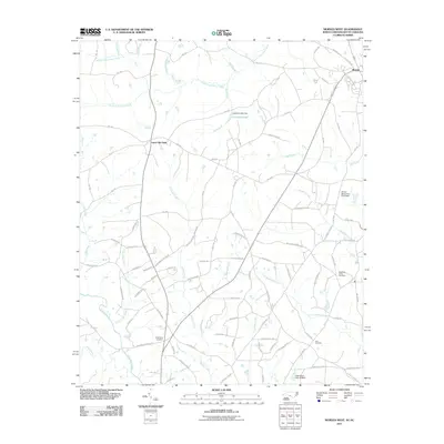
2011 Map of Morven West
USGS Topo · Published 2011About this map
Morven anchors the upper right corner of this survey, where the Old Plank Rd meets contemporary state routes. The landscape transitions from the small town center into a dense network of family-named roads and rural infrastructure in Anson County. Numerous burial grounds are scattered through the countryside, including the Westfield Creek Cemetery, Friendship Cemetery, and Zoar Cemetery, providing significant touchpoints for local genealogical research.
Find a feature on this map
99 named features on this map. Tap any name to fly to it.
Don’t see what you’re looking for? This feature index may not catch every label — zoom into the map to look around manually.
Map Details
Editions of this 2011 Morven West Map
This is the sole edition of this map. No revisions or reprints were ever made.
Other maps of this area

1941 · Spartanburg
USGS Topo · 1:250,000

1942 · Rockingham
USGS Topo · 1:125,000

1953 · Florence
USGS Topo · 1:250,000

1953 · Spartanburg
USGS Topo · 1:250,000

1954 · Florence
USGS Topo · 1:250,000
1956 · Lilesville
USGS Topo · 1:24,000

1956 · Wadesboro
USGS Topo · 1:24,000

1960 · Spartanburg
USGS Topo · 1:250,000

1963 · Spartanburg
USGS Topo · 1:250,000

1964 · Spartanburg
USGS Topo · 1:250,000