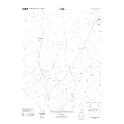
2013 Map of Morven West
USGS Topo · Published 2013About this map
Cason Old Field and the outlying rural corridors of Morven define this Piedmont landscape, where the land is deeply etched by a network of creeks. Waterways such as S Fork Jones Cr, Westfield Cr, and Jimmies Cr dictate the local geography, flowing around significant landmarks like Crawford Lake. The survey reveals a landscape of family-named roads and rural connections, with David Grove Church Rd and Teal Cemetery Rd providing vital links for local residents and genealogists tracing community roots.
Find a feature on this map
110 named features on this map. Tap any name to fly to it.
Don’t see what you’re looking for? This feature index may not catch every label — zoom into the map to look around manually.
Map Details
Editions of this 2013 Morven West Map
This is the sole edition of this map. No revisions or reprints were ever made.
Other maps of this area

1941 · Spartanburg
USGS Topo · 1:250,000

1942 · Rockingham
USGS Topo · 1:125,000

1953 · Florence
USGS Topo · 1:250,000

1953 · Spartanburg
USGS Topo · 1:250,000

1954 · Florence
USGS Topo · 1:250,000
1956 · Lilesville
USGS Topo · 1:24,000

1956 · Wadesboro
USGS Topo · 1:24,000

1960 · Spartanburg
USGS Topo · 1:250,000

1963 · Spartanburg
USGS Topo · 1:250,000

1964 · Spartanburg
USGS Topo · 1:250,000