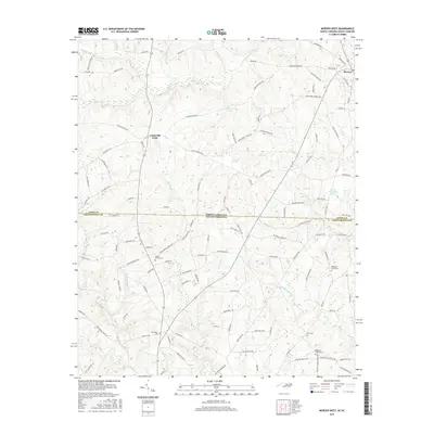
2016 Map of Morven West
USGS Topo · Published 2016About this map
The town of Morven sits at the northern edge of this Piedmont landscape, where the border between North Carolina and South Carolina divides Anson and Chesterfield counties. The area is defined by a dense network of small waterways and family-named landmarks that reflect a long-standing rural settlement pattern. Numerous local burial grounds, such as Davids Grove Cem and Friendship Cem, are scattered throughout the countryside, providing a clear geographic record for genealogical research.
Find a feature on this map
121 named features on this map. Tap any name to fly to it.
Don’t see what you’re looking for? This feature index may not catch every label — zoom into the map to look around manually.
Map Details
Editions of this 2016 Morven West Map
This is the sole edition of this map. No revisions or reprints were ever made.
Other maps of this area

1941 · Spartanburg
USGS Topo · 1:250,000

1942 · Rockingham
USGS Topo · 1:125,000

1953 · Florence
USGS Topo · 1:250,000

1953 · Spartanburg
USGS Topo · 1:250,000

1954 · Florence
USGS Topo · 1:250,000
1956 · Lilesville
USGS Topo · 1:24,000

1956 · Wadesboro
USGS Topo · 1:24,000

1960 · Spartanburg
USGS Topo · 1:250,000

1963 · Spartanburg
USGS Topo · 1:250,000

1964 · Spartanburg
USGS Topo · 1:250,000