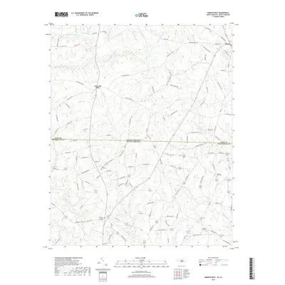
2019 Map of Morven West
USGS Topo · Published 2019About this map
Morven and Cason Old Field anchor the northern landscape of this region, where the state line between North Carolina and South Carolina bisects a network of rural roads and creek beds. The drainage pattern is complex, with the S Fork Jones Cr and Thompson Creek system carving through the terrain alongside smaller tributaries like Jimmies Cr and Smursh Br. This landscape is particularly rich for genealogical research, documenting numerous small burial grounds and places of worship tucked away from the main thoroughfares.
Find a feature on this map
118 named features on this map. Tap any name to fly to it.
Don’t see what you’re looking for? This feature index may not catch every label — zoom into the map to look around manually.
Map Details
Editions of this 2019 Morven West Map
This is the sole edition of this map. No revisions or reprints were ever made.
Other maps of this area

1941 · Spartanburg
USGS Topo · 1:250,000

1942 · Rockingham
USGS Topo · 1:125,000

1953 · Florence
USGS Topo · 1:250,000

1953 · Spartanburg
USGS Topo · 1:250,000

1954 · Florence
USGS Topo · 1:250,000
1956 · Lilesville
USGS Topo · 1:24,000

1956 · Wadesboro
USGS Topo · 1:24,000

1960 · Spartanburg
USGS Topo · 1:250,000

1963 · Spartanburg
USGS Topo · 1:250,000

1964 · Spartanburg
USGS Topo · 1:250,000