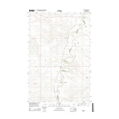
2014 Map of Mosby
USGS Topo · Published 2014About this map
Mosby sits at the northern edge of this central Montana landscape, where the Mosby Bridge carries MT-200 across the meandering Musselshell River. This 2014 survey documents the rugged drainage systems that define the boundary between Petroleum and Garfield Counties, showing a terrain carved by numerous coulees. The river's winding course is mirrored by the jurisdictional line as it snakes through the valley.
Find a feature on this map
21 named features on this map. Tap any name to fly to it.
Don’t see what you’re looking for? This feature index may not catch every label — zoom into the map to look around manually.
Map Details
Editions of this 2014 Mosby Map
This is the sole edition of this map. No revisions or reprints were ever made.
Other maps of this area

1954 · Jordan
USGS Topo · 1:250,000

1954 · Forsyth
USGS Topo · 1:250,000

1954 · Roundup
USGS Topo · 1:250,000

1954 · Lewistown
USGS Topo · 1:250,000

1956 · Jordan
USGS Topo · 1:250,000

1957 · Forsyth
USGS Topo · 1:250,000

1958 · Jordan
USGS Topo · 1:250,000

1958 · Roundup
USGS Topo · 1:250,000

1958 · Forsyth
USGS Topo · 1:250,000

1959 · Lewistown
USGS Topo · 1:250,000