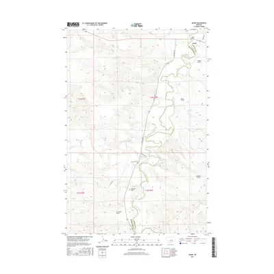
2017 Map of Mosby
USGS Topo · Published 2017About this map
The Musselshell River carves a winding path through the heart of this central Montana landscape, defining the jagged border between Petroleum and Garfield Counties. The small settlement of Mosby sits at the northern edge of the survey area, anchored by the Mosby Bridge crossing. This territory is characterized by its complex drainage network, where numerous dry washes and seasonal streams have etched deep features into the earth, including Circle Bar Coulee, Anderson Coulee, and Nineteen Coulee.
Find a feature on this map
20 named features on this map. Tap any name to fly to it.
Don’t see what you’re looking for? This feature index may not catch every label — zoom into the map to look around manually.
Map Details
Editions of this 2017 Mosby Map
This is the sole edition of this map. No revisions or reprints were ever made.
Other maps of this area

1954 · Jordan
USGS Topo · 1:250,000

1954 · Forsyth
USGS Topo · 1:250,000

1954 · Roundup
USGS Topo · 1:250,000

1954 · Lewistown
USGS Topo · 1:250,000

1956 · Jordan
USGS Topo · 1:250,000

1957 · Forsyth
USGS Topo · 1:250,000

1958 · Jordan
USGS Topo · 1:250,000

1958 · Roundup
USGS Topo · 1:250,000

1958 · Forsyth
USGS Topo · 1:250,000

1959 · Lewistown
USGS Topo · 1:250,000