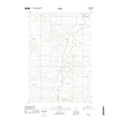
2020 Map of Mosby
USGS Topo · Published 2020About this map
The Musselshell River winds through this central Montana landscape, creating a serpentine boundary between Petroleum and Garfield counties. Near the northern edge, the settlement of Mosby sits at a strategic crossing point where the Mosby Bridge spans the water. The terrain is defined by a complex network of drainages, including Hughes Coulee, Anderson Coulee, and Circle Bar Coulee, which cut into the high ground. Ranching history is evident through family-named landmarks such as Hill Ranch and Maxwell Ranch. Water management is critical in this arid environment, marked by features like the Shaw Reservoir and the confluence where Flatwillow Cr feeds into the main river channel. Local routes like Melstone Rd and the Old Melstone Rd track the high ridges above the river valley.
Find a feature on this map
27 named features on this map. Tap any name to fly to it.
Don’t see what you’re looking for? This feature index may not catch every label — zoom into the map to look around manually.
Map Details
Editions of this 2020 Mosby Map
This is the sole edition of this map. No revisions or reprints were ever made.
Other maps of this area

1954 · Jordan
USGS Topo · 1:250,000

1954 · Forsyth
USGS Topo · 1:250,000

1954 · Roundup
USGS Topo · 1:250,000

1954 · Lewistown
USGS Topo · 1:250,000

1956 · Jordan
USGS Topo · 1:250,000

1957 · Forsyth
USGS Topo · 1:250,000

1958 · Jordan
USGS Topo · 1:250,000

1958 · Roundup
USGS Topo · 1:250,000

1958 · Forsyth
USGS Topo · 1:250,000

1959 · Lewistown
USGS Topo · 1:250,000