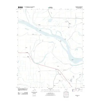
2011 Map of Moscow
USGS Topo · Published 2011About this map
Moscow and the adjacent community of Linwood anchor this survey of the Arkansas riverfront in Jefferson County. The landscape is defined by the shifting course of the Arkansas River, which carves dramatic features such as Trulock Bend and Richland Bend across the territory. A high concentration of burial grounds, including New Gascony Cemetery, Saint Peters Cemetery, and Hunters Cemetery, suggests a long-settled rural history and provides significant data points for genealogists tracing families in this river-bottom region.
Find a feature on this map
50 named features on this map. Tap any name to fly to it.
Don’t see what you’re looking for? This feature index may not catch every label — zoom into the map to look around manually.
Map Details
Editions of this 2011 Moscow Map
This is the sole edition of this map. No revisions or reprints were ever made.
Other maps of this area

1935 · Altheimer
USGS Topo · 1:62,500

1935 · Varner
USGS Topo · 1:62,500

1935 · Noble Lake
USGS Topo · 1:62,500

1941 · Goldman
USGS Topo · 1:62,500

1948 · Helena
USGS Topo · 1:250,000

1950 · Helena
USGS Topo · 1:250,000

1955 · Helena
USGS Topo · 1:250,000

1959 · Helena
USGS Topo · 1:250,000

1960 · Helena
USGS Topo · 1:250,000
1964 · Tarry
USGS Topo · 1:24,000