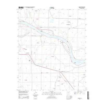
2014 Map of Moscow
USGS Topo · Published 2014About this map
Arkansas River meanders through this section of Jefferson County, defining a landscape of sharp bends and oxbow remnants like Noble Lake and Atkins Lake. The settlement patterns here are deeply tied to the river's historical course, evidenced by features such as Trulock Bend and Richland Bend. Small communities like New Gascony, Madding, and Moscow serve as anchors for the surrounding rural territory, which is punctuated by a high density of small family or community burial grounds. Researchers will find numerous genealogical sites including Mulberry Grove Cem, Saint Ruth Cem, and Blackman Cem. The intricate network of bayous, such as Jacks Bayou and Riley Bayou, illustrates the complex drainage and fertile bottomlands that have historically supported the agricultural character of this Arkansas Delta region.
Find a feature on this map
59 named features on this map. Tap any name to fly to it.
Don’t see what you’re looking for? This feature index may not catch every label — zoom into the map to look around manually.
Map Details
Editions of this 2014 Moscow Map
This is the sole edition of this map. No revisions or reprints were ever made.
Other maps of this area

1935 · Altheimer
USGS Topo · 1:62,500

1935 · Varner
USGS Topo · 1:62,500

1935 · Noble Lake
USGS Topo · 1:62,500

1941 · Goldman
USGS Topo · 1:62,500

1948 · Helena
USGS Topo · 1:250,000

1950 · Helena
USGS Topo · 1:250,000

1955 · Helena
USGS Topo · 1:250,000

1959 · Helena
USGS Topo · 1:250,000

1960 · Helena
USGS Topo · 1:250,000
1964 · Tarry
USGS Topo · 1:24,000