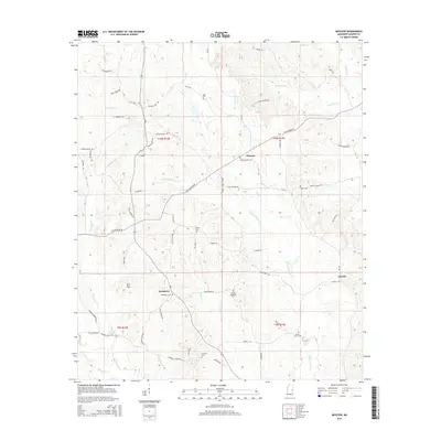
2015 Map of Moscow
USGS Topo · Published 2015About this map
Moscow and Damascus sit at the center of this rural Mississippi landscape, where the headwaters of the Chickasawhay Cr begin their southward trek. The terrain is characterized by a high density of family and community burial grounds, including the West Kemper Cem, McDonald Cem, and Linwood Cem, which serve as vital markers for local genealogical research. The road network, featuring routes like Old Jackson Rd and Liberty Rd, connects these small settlements across a dissected landscape of ridges and creek bottoms. Significant watercourses such as Pawticfaw Cr and Tallachula Cr define the drainage patterns around Bull Mtn, illustrating the rural isolation and agricultural layout of the region during the early 21st century.
Find a feature on this map
62 named features on this map. Tap any name to fly to it.
Don’t see what you’re looking for? This feature index may not catch every label — zoom into the map to look around manually.
Map Details
Editions of this 2015 Moscow Map
This is the sole edition of this map. No revisions or reprints were ever made.
Other maps of this area

1953 · Meridian
USGS Topo · 1:250,000

1957 · Meridian
USGS Topo · 1:250,000

1962 · House
USGS Topo · 1:24,000

1962 · Lynville
USGS Topo · 1:24,000

1962 · Daleville
USGS Topo · 1:24,000

1962 · Owl Creek
USGS Topo · 1:24,000

1962 · Lauderdale NW
USGS Topo · 1:24,000

1962 · Center Hill
USGS Topo · 1:24,000

1962 · Post
USGS Topo · 1:24,000

1962 · Moscow
USGS Topo · 1:24,000