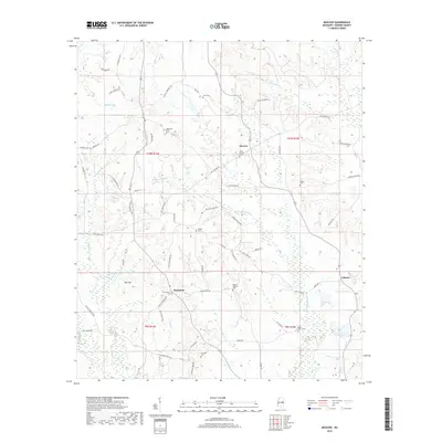
2018 Map of Moscow
USGS Topo · Published 2018About this map
Moscow and Damascus anchor this section of Kemper County, where the headwaters of several significant creek systems emerge from the local highlands. The landscape is defined by the high ground of Bull Mtn and the intricate drainage of Chickasawhay Cr, Bogue Chitto, and Pawticfaw Cr. This map reveals a community organized around family lineage and local faith, as evidenced by the high density of small cemeteries including Cole, McDonald, and Linwood. Many of these are reached by roads bearing local family names like Ross Rd and Jimmy Bounds Rd. The settlement of Liberty sits in the southeast corner, connected to the larger community by a network of rural routes such as Old Jackson Rd, illustrating the persistent rural character of this region of east-central Mississippi.
Find a feature on this map
64 named features on this map. Tap any name to fly to it.
Don’t see what you’re looking for? This feature index may not catch every label — zoom into the map to look around manually.
Map Details
Editions of this 2018 Moscow Map
This is the sole edition of this map. No revisions or reprints were ever made.
Other maps of this area

1953 · Meridian
USGS Topo · 1:250,000

1957 · Meridian
USGS Topo · 1:250,000

1962 · House
USGS Topo · 1:24,000

1962 · Lynville
USGS Topo · 1:24,000

1962 · Daleville
USGS Topo · 1:24,000

1962 · Owl Creek
USGS Topo · 1:24,000

1962 · Lauderdale NW
USGS Topo · 1:24,000

1962 · Center Hill
USGS Topo · 1:24,000

1962 · Post
USGS Topo · 1:24,000

1962 · Moscow
USGS Topo · 1:24,000