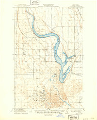
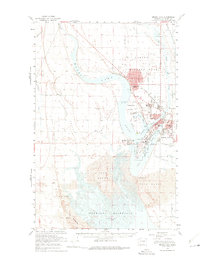
1982 Map of Moses Lake
USGS Topo · Published 1983About this map
The agricultural and military landscape of central Washington's Columbia Basin is defined here by the extensive water management systems of the early 1980s. Moses Lake and the Potholes Reservoir anchor the southern portion of the sheet, surrounded by various units of the North Columbia Basin State Wildlife Recreation Area. This period shows the region's transition into a major aviation and transit hub, with Larson Air Force Base positioned north of the city and the Burlington Northern railroad connecting established towns like Ephrata and Quincy.
Find a feature on this map
98 named features on this map. Tap any name to fly to it.
Don’t see what you’re looking for? This feature index may not catch every label — zoom into the map to look around manually.
Map Details
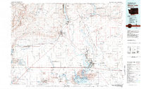
Editions of this 1982 Moses Lake Map
2 editions found
Historical Maps of Moses Lake Through Time
3 maps found