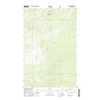
2017 Map of Moses Meadows
USGS Topo · Published 2017About this map
Moses Meadows and the surrounding high country of the Okanogan National Forest define this landscape in north-central Washington. The terrain is characterized by a series of prominent peaks and drainages, including Granite Mtn and Little Moses Mtn, which overlook a network of seasonal and perennial waters such as Moses Cr, Lost Cr, and Loony Cr. This 2017 survey details the access routes through the timber, from the winding Cobey Trl Rd to Bia RD 1024, reflecting the area's continued use for resource management and recreation. The placement of Cox Meadow and Cox Spring in the northern reaches suggests long-standing landmarks for navigation and grazing in this remote interior of Okanogan County. Geographers and local historians can trace the intricate boundary lines of the Township and Range system as they overlay the diverse topography of Mackey Ridge.
Find a feature on this map
27 named features on this map. Tap any name to fly to it.
Don’t see what you’re looking for? This feature index may not catch every label — zoom into the map to look around manually.
Map Details
Editions of this 2017 Moses Meadows Map
This is the sole edition of this map. No revisions or reprints were ever made.
Other maps of this area

1902 · Osoyoos
USGS Topo · 1:125,000

1904 · Osoyoos
USGS Topo · 1:125,000

1904 · Republic
USGS Topo · 1:125,000

1951 · Wauconda
USGS Topo · 1:62,500

1952 · Disautel
USGS Topo · 1:62,500

1953 · Bald Knob
USGS Topo · 1:62,500

1954 · Okanogan
USGS Topo · 1:250,000

1957 · Aeneas Valley
USGS Topo · 1:62,500

1958 · Okanogan
USGS Topo · 1:250,000

1958 · Aeneas
USGS Topo · 1:62,500