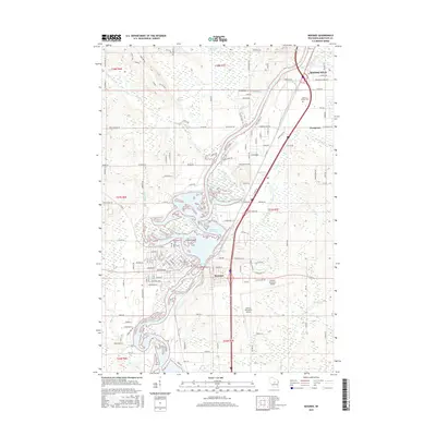
2015 Map of Mosinee
USGS Topo · Published 2015About this map
The Wisconsin River corridor defines the landscape of this 2015 survey, flowing through a series of impoundments including the Mosinee Flowage and the northern reaches of Lake DuBay. The city of Mosinee serves as the central hub, situated where the river narrows between the flowage and the surrounding wetlands of Cemetery Slough. This era shows a well-developed transportation and aviation network, anchored by the Central Wisconsin Airport and the CN railroad line that tracks the river's eastern bank. Local history and genealogy interests are well-served by the presence of several established burial grounds, such as Mosinee Cem and Saint Paul Cem near the town center, and the Gate of Heaven Cem further north. The northern boundary includes the edge of Rothschild and the expansive Ninemile Swamp, illustrating the transition from industrial riverfront to managed wilderness.
Find a feature on this map
191 named features on this map. Tap any name to fly to it.
Don’t see what you’re looking for? This feature index may not catch every label — zoom into the map to look around manually.
Map Details
Editions of this 2015 Mosinee Map
This is the sole edition of this map. No revisions or reprints were ever made.
Other maps of this area

1899 · Wausau
USGS Topo · 1:125,000

1902 · Wausau
USGS Topo · 1:125,000

1902 · Marathon
USGS Topo · 1:125,000

1953 · Wausau
USGS Topo · 1:48,000

1953 · Marathon
USGS Topo · 1:48,000

1955 · Green Bay
USGS Topo · 1:250,000

1956 · Milladore
USGS Topo · 1:48,000

1956 · Stevens Point
USGS Topo · 1:48,000

1963 · Wausau West
USGS Topo · 1:24,000

1963 · Marathon
USGS Topo · 1:62,500