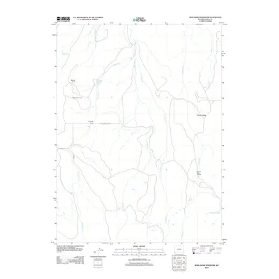
2012 Map of Moslander Reservoir
USGS Topo · Published 2012About this map
The Blacks Fork Sheep Trl cuts across the center of this high plains landscape in Uinta County, marking a historic route for livestock movement in Wyoming. In this arid terrain, water sources define the geography, from the eponymous Moslander Reservoir to the secluded Seventeen Spring and Cold Springs. The map illustrates a network of ephemeral and perennial drainages such as Van Tassel Cr and W Muddy Cr, which carve through features like Twomile Draw and Beaver Dam Hollow.
Find a feature on this map
20 named features on this map. Tap any name to fly to it.
Don’t see what you’re looking for? This feature index may not catch every label — zoom into the map to look around manually.
Map Details
Editions of this 2012 Moslander Reservoir Map
This is the sole edition of this map. No revisions or reprints were ever made.
Other maps of this area

1885 · Uinta
USGS Topo · 1:250,000

1901 · Hayden Peak
USGS Topo · 1:125,000

1903 · Hayden Peak
USGS Topo · 1:125,000

1954 · Salt Lake City
USGS Topo · 1:250,000

1954 · Ogden
USGS Topo · 1:250,000

1958 · Ogden
USGS Topo · 1:250,000

1958 · Salt Lake City
USGS Topo · 1:250,000

1960 · Ogden
USGS Topo · 1:250,000

1960 · Salt Lake City
USGS Topo · 1:250,000

1965 · Sulphur Creek Reservoir
USGS Topo · 1:24,000