
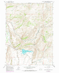
1965 Map of Sulphur Creek Reservoir
USGS Topo · Published 1968About this map
The Union Pacific Railroad cuts through the high country of Uinta County, winding through the complex terrain of Knight Ridge and Oyster Shell Ridge. This mid-1960s survey captures a landscape defined by the intersection of historic overland travel and modern infrastructure. The Emigrant Trail is clearly delineated as it traverses the ridges, while the Sulphur Creek Reservoir dominates the lower elevations of Hilliard Flat. Settlement patterns are concentrated near the rail line and water sources, with locations such as Altamont, Aspen, and Beartown serving as focal points for local activity.
Find a feature on this map
37 named features on this map. Tap any name to fly to it.
Don’t see what you’re looking for? This feature index may not catch every label — zoom into the map to look around manually.
Map Details
Editions of this 1965 Sulphur Creek Reservoir Map
2 editions found
Other maps of this area

1954 · Ogden
USGS Topo · 1:250,000

1958 · Ogden
USGS Topo · 1:250,000

1960 · Ogden
USGS Topo · 1:250,000

1965 · Evanston
USGS Topo · 1:24,000

1965 · Ragan
USGS Topo · 1:24,000

1965 · Myers Reservoir
USGS Topo · 1:24,000

1965 · Guild Hollow
USGS Topo · 1:24,000
1965 · Pine Knoll
USGS Topo · 1:24,000
1965 · Moslander Reservoir
USGS Topo · 1:24,000

1965 · Millis
USGS Topo · 1:24,000