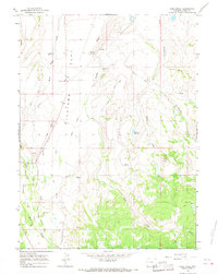
1965 Map of Pine Knoll
USGS Topo · Published 1968About this map
Hilliard Flat serves as the focal point of this mid-1960s survey, illustrating a landscape defined by extensive water management and high-desert terrain near the Utah border. The agricultural activity of the era is evidenced by an intricate network of irrigation projects, including the Bear River Canal, Westside Canal, and the Hilliard Ditch. These systems divert water to support the ranching and farming operations that surround Hilliard Ward Ch.
Find a feature on this map
31 named features on this map. Tap any name to fly to it.
Don’t see what you’re looking for? This feature index may not catch every label — zoom into the map to look around manually.
Map Details
Editions of this 1965 Pine Knoll Map
3 editions found
Other maps of this area

1885 · Uinta
USGS Topo · 1:250,000

1901 · Hayden Peak
USGS Topo · 1:125,000

1903 · Hayden Peak
USGS Topo · 1:125,000

1954 · Salt Lake City
USGS Topo · 1:250,000

1954 · Ogden
USGS Topo · 1:250,000

1958 · Ogden
USGS Topo · 1:250,000

1958 · Salt Lake City
USGS Topo · 1:250,000

1960 · Ogden
USGS Topo · 1:250,000

1960 · Salt Lake City
USGS Topo · 1:250,000

1965 · Myers Reservoir
USGS Topo · 1:24,000