
1965 Map of Ragan
USGS Topo · Published 1968About this map
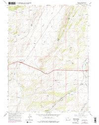
The Emigrant Trail cuts across the southern portion of this Uinta County landscape, following the same corridor as the Union Pacific railroad and the Soda Aqueduct. This section of Wyoming reflects a complex layering of transportation and extraction history, where early overland migration paths converge with mid-century industrial infrastructure. Numerous Oil Wells are scattered through the hills, alongside older operations like Jakes Mine, Coal Mine, and Lazeart Mine.
Find a feature on this map
33 named features on this map. Tap any name to fly to it.
Don’t see what you’re looking for? This feature index may not catch every label — zoom into the map to look around manually.
Map Details
Editions of this 1965 Ragan Map
3 editions found
Other maps of this area

1954 · Ogden
USGS Topo · 1:250,000

1958 · Ogden
USGS Topo · 1:250,000

1960 · Ogden
USGS Topo · 1:250,000

1965 · Bridger
USGS Topo · 1:24,000

1965 · Leroy
USGS Topo · 1:24,000

1965 · Little Dee Creek
USGS Topo · 1:24,000

1965 · Meadow Draw
USGS Topo · 1:24,000

1965 · Sulphur Creek Reservoir
USGS Topo · 1:24,000
1965 · Hague Creek
USGS Topo · 1:24,000

1965 · Guild Hollow
USGS Topo · 1:24,000