
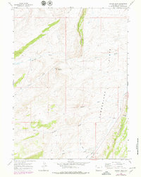
1965 Map of Meadow Draw
USGS Topo · Published 1968About this map
Cumberland and the surrounding high-altitude drainage basins of southwestern Wyoming are defined here by a series of parallel ridges and distinct geologic landmarks. This mid-1960s mapping effort records a remote landscape where land use was primarily focused on industrial extraction and livestock grazing, evidenced by scattered Gravel Pits and a network of Jeep Trails. The topography is dominated by the north-south alignment of Little Hogsback and The Hogsback, which guide the flow of ephemeral watercourses like Meadow Draw and Toms Draw. The presence of Byrne in the southern portion of the sheet provides a reference point for local history researchers tracing early Uinta County ranching or transportation routes. This area, located near Bridger Gap, showcases the complex hydrography of the region where Clear Creek and Shurtleff Creek carve through the high Flats.
Find a feature on this map
19 named features on this map. Tap any name to fly to it.
Don’t see what you’re looking for? This feature index may not catch every label — zoom into the map to look around manually.
Map Details
Editions of this 1965 Meadow Draw Map
2 editions found
Other maps of this area

1954 · Ogden
USGS Topo · 1:250,000

1958 · Ogden
USGS Topo · 1:250,000

1960 · Ogden
USGS Topo · 1:250,000

1962 · Cumberland Gap
USGS Topo · 1:24,000

1962 · Elkol SW
USGS Topo · 1:24,000

1962 · Bell Butte
USGS Topo · 1:24,000

1965 · Bridger
USGS Topo · 1:24,000

1965 · Ragan
USGS Topo · 1:24,000

1965 · Leroy
USGS Topo · 1:24,000

1965 · Little Dee Creek
USGS Topo · 1:24,000