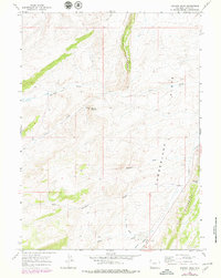
1965 Map of Meadow Draw
USGS Topo · Published 1979About this map
Little Hogsback and the parallel ridge of The Hogsback define the North-South topographical grain of this Uinta County landscape. The area is characterized by a series of high ridges and broad drainage systems, including the headwaters and tributaries of Clear Creek and Albert Creek. Evidence of early motorized transit is visible via the 189 highway corridor and a surviving Jeep Trail winding through the northern hills.
Find a feature on this map
22 named features on this map. Tap any name to fly to it.
Don’t see what you’re looking for? This feature index may not catch every label — zoom into the map to look around manually.
Map Details
Editions of this 1965 Meadow Draw Map
2 editions found

Other maps of this area

1954 · Ogden
USGS Topo · 1:250,000

1958 · Ogden
USGS Topo · 1:250,000

1960 · Ogden
USGS Topo · 1:250,000

1962 · Cumberland Gap
USGS Topo · 1:24,000

1962 · Elkol SW
USGS Topo · 1:24,000

1962 · Bell Butte
USGS Topo · 1:24,000

1965 · Bridger
USGS Topo · 1:24,000

1965 · Ragan
USGS Topo · 1:24,000

1965 · Leroy
USGS Topo · 1:24,000

1965 · Little Dee Creek
USGS Topo · 1:24,000