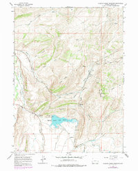
1965 Map of Sulphur Creek Reservoir
USGS Topo · Published 1979About this map
Union Pacific rail lines dominate this landscape in Uinta County, Wyoming, threading through the high terrain via the Aspen Tunnel and passing the industrial settlement at Altamont. The topography is defined by prominent elevations such as Knight Ridge and the uniquely named Oyster Shell Ridge, which overlook the waters of the Sulphur Creek Reservoir. The presence of the Emigrant Trail weaving through the ridges offers a glimpse into the historic westward movement that preceded the heavy industrial development of the region.
Find a feature on this map
37 named features on this map. Tap any name to fly to it.
Don’t see what you’re looking for? This feature index may not catch every label — zoom into the map to look around manually.
Map Details
Editions of this 1965 Sulphur Creek Reservoir Map
2 editions found
Other maps of this area

1954 · Ogden
USGS Topo · 1:250,000

1958 · Ogden
USGS Topo · 1:250,000

1960 · Ogden
USGS Topo · 1:250,000

1965 · Evanston
USGS Topo · 1:24,000

1965 · Ragan
USGS Topo · 1:24,000

1965 · Myers Reservoir
USGS Topo · 1:24,000

1965 · Sulphur Creek Reservoir
USGS Topo · 1:24,000

1965 · Guild Hollow
USGS Topo · 1:24,000
1965 · Pine Knoll
USGS Topo · 1:24,000
1965 · Moslander Reservoir
USGS Topo · 1:24,000