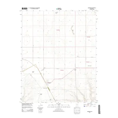
2013 Map of Mosquero
USGS Topo · Published 2013About this map
Mosquero serves as the focal point for this Northeastern New Mexico landscape, situated on the border of Harding Co and San Miguel Co. The town is flanked by significant burial sites, including the Mosquero Cem and Saint Joseph Cem, which reflect the community's genealogy and heritage. The topography is defined by its dramatic drainage patterns, where canyons such as Ensinosa Canyon, Mosquero Canyon, and Fragoso Canyon cut through the high plains.
Find a feature on this map
32 named features on this map. Tap any name to fly to it.
Don’t see what you’re looking for? This feature index may not catch every label — zoom into the map to look around manually.
Map Details
Editions of this 2013 Mosquero Map
This is the sole edition of this map. No revisions or reprints were ever made.
Other maps of this area

1954 · Santa Fe
USGS Topo · 1:250,000

1954 · Tucumcari
USGS Topo · 1:250,000

1958 · Santa Fe
USGS Topo · 1:250,000

1958 · Tucumcari
USGS Topo · 1:250,000

1969 · Salitre Canyon
USGS Topo · 1:24,000

1969 · Chinaberry Canyon
USGS Topo · 1:24,000

1972 · Waggoner Ranch
USGS Topo · 1:24,000

1973 · Mosquero
USGS Topo · 1:24,000

1973 · Sabino
USGS Topo · 1:24,000
1973 · Albert
USGS Topo · 1:24,000