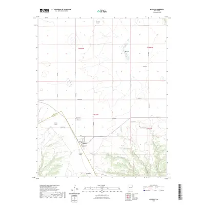
2023 Map of Mosquero
USGS Topo · Published 2023About this map
Mosquero serves as a focal point in this high-plains landscape, situated at the edge of significant canyon systems. The village layout is clearly defined by a grid including Main St and Lakefront Blvd, with the Harding County Courthouse anchoring the local administration. To the north, the land is marked by numerous ephemeral features like Black Lake and a series of rural routes such as Heimann Rd and Allen Rd.
Find a feature on this map
44 named features on this map. Tap any name to fly to it.
Don’t see what you’re looking for? This feature index may not catch every label — zoom into the map to look around manually.
Map Details
Editions of this 2023 Mosquero Map
This is the sole edition of this map. No revisions or reprints were ever made.
Other maps of this area

1954 · Santa Fe
USGS Topo · 1:250,000

1954 · Tucumcari
USGS Topo · 1:250,000

1958 · Santa Fe
USGS Topo · 1:250,000

1958 · Tucumcari
USGS Topo · 1:250,000

1969 · Salitre Canyon
USGS Topo · 1:24,000

1969 · Chinaberry Canyon
USGS Topo · 1:24,000

1972 · Waggoner Ranch
USGS Topo · 1:24,000

1973 · Mosquero
USGS Topo · 1:24,000

1973 · Sabino
USGS Topo · 1:24,000
1973 · Albert
USGS Topo · 1:24,000