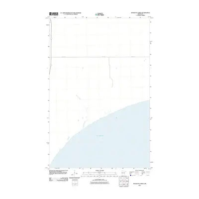
2010 Map of Mosquito Creek
USGS Topo · Published 2010About this map
Lower Red Lake dominates the southern reaches of this landscape, its expansive shoreline meeting a network of drainage and wetlands in Beltrami County. Flowing from the interior toward the lake, Mosquito Creek serves as a primary watercourse through the low-lying northern terrain. This area, largely defined by its hydrological features, is traversed by Res Hwy 27, which provides the primary terrestrial corridor across the quadrangle. The map captures the interface between the open water of one of Minnesota's largest lakes and the surrounding marshy woodlands, illustrating the seasonal and ecological patterns of the Red Lake Reservation area.
Find a feature on this map
3 named features on this map. Tap any name to fly to it.
Don’t see what you’re looking for? This feature index may not catch every label — zoom into the map to look around manually.
Map Details
Editions of this 2010 Mosquito Creek Map
This is the sole edition of this map. No revisions or reprints were ever made.
Other maps of this area

1918 · Jelle
USGS Topo · 1:62,500

1919 · Churnes
USGS Topo · 1:62,500

1954 · Bemidji
USGS Topo · 1:250,000

1954 · Roseau
USGS Topo · 1:250,000

1957 · Roseau
USGS Topo · 1:250,000

1957 · Bemidji
USGS Topo · 1:250,000

1958 · Bemidji
USGS Topo · 1:250,000

1958 · Roseau
USGS Topo · 1:250,000
1972 · Berner NE
USGS Topo · 1:24,000

1973 · Manomin Creek SE
USGS Topo · 1:24,000