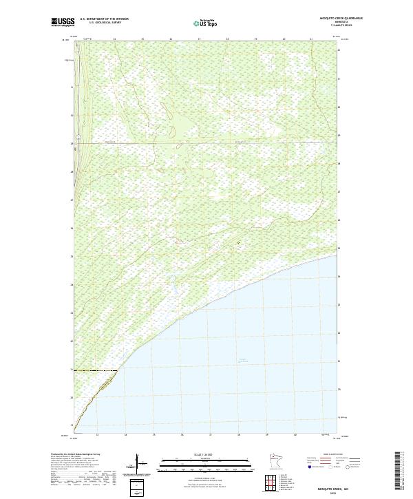
2022 Map of Mosquito Creek
USGS Topo · Published 2022About this map
Lower Red Lake dominates the southern landscape of this northern Minnesota region, where the shoreline meets an extensive network of wetlands and small waterways. The terrain is defined by the drainage of Mosquito Cr, which flows toward the massive lake basin through a largely uninhabited expanse of the Red Lake Indian Reservation. A single primary thoroughfare, Resvn Hwy 27, provides the only major east-west terrestrial access through the townships of T154N and T153N. The map also delineates the administrative boundary between Clearwater Co and Beltrami Co as it intersects the shoreline. This 2022 survey illustrates a landscape preserved in its natural state, characterized by the intricate hydrography of the boggy lowlands that feed into one of the state's largest freshwater bodies.
Find a feature on this map
10 named features on this map. Tap any name to fly to it.
Don’t see what you’re looking for? This feature index may not catch every label — zoom into the map to look around manually.
Map Details
Editions of this 2022 Mosquito Creek Map
This is the sole edition of this map. No revisions or reprints were ever made.
Other maps of this area

1918 · Jelle
USGS Topo · 1:62,500

1919 · Churnes
USGS Topo · 1:62,500

1954 · Bemidji
USGS Topo · 1:250,000

1954 · Roseau
USGS Topo · 1:250,000

1957 · Roseau
USGS Topo · 1:250,000

1957 · Bemidji
USGS Topo · 1:250,000

1958 · Bemidji
USGS Topo · 1:250,000

1958 · Roseau
USGS Topo · 1:250,000
1972 · Berner NE
USGS Topo · 1:24,000

1973 · Manomin Creek SE
USGS Topo · 1:24,000