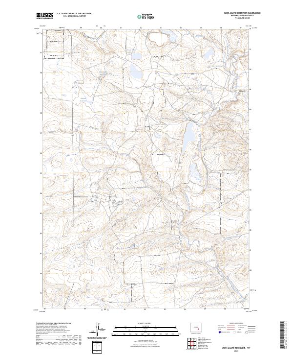
2023 Map of Moss Agate Reservoir
USGS Topo · Published 2023About this map
The Little Medicine Bow River winds through this Carbon County landscape, defining the local hydrology alongside several high-plains water catchments. The terrain is marked by the prominent Moss Agate Ridge and the nearby Moss Agate Reservoir, highlighting a region historically focused on water management in an arid environment. Transportation and industrial access are evident through named routes such as the Shirley Basin Access Rd and the Utah Mining Camp Spr, the latter suggesting a legacy of mineral exploration and encampments common to this part of Wyoming. Local infrastructure is further detailed by the intersections of Shirley Ridge Rd and several county roads, which connect remote features like Heward Reservoir and Fresh Water Reservoir. The layout of streets such as Antelope St and Badger St indicates small pockets of surveyed development within the broader landscape of Chalk Draw and Spring Creek.
Find a feature on this map
24 named features on this map. Tap any name to fly to it.
Don’t see what you’re looking for? This feature index may not catch every label — zoom into the map to look around manually.
Map Details
Editions of this 2023 Moss Agate Reservoir Map
This is the sole edition of this map. No revisions or reprints were ever made.
Other maps of this area

1955 · Casper
USGS Topo · 1:250,000

1958 · Casper
USGS Topo · 1:250,000

1959 · Moss Agate Reservoir
USGS Topo · 1:24,000

1959 · Squaw Spring
USGS Topo · 1:24,000

1959 · Chalk Hills
USGS Topo · 1:24,000

1959 · Bates Creek Reservoir
USGS Topo · 1:24,000

1960 · Mud Springs
USGS Topo · 1:24,000

1960 · Measel Spring Reservoir
USGS Topo · 1:24,000
1961 · Big Charlie Lakes
USGS Topo · 1:24,000
1961 · Cameron Creek
USGS Topo · 1:24,000