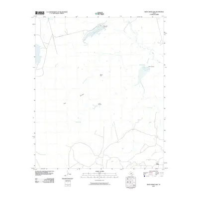
2010 Map of Moss Creek Lake
USGS Topo · Published 2010About this map
Otis Chalk anchors the southeastern corner of this West Texas landscape, a region defined by its managed water resources and distinct topographic breaks. The topography is dominated by the Signal Mountains, with the prominent Signal Peak rising as a primary landmark above the surrounding plains. The local hydrology is heavily engineered, featuring several significant impoundments including Moss Creek Lake, Powell Lake, and Garrett Lake, each supported by their respective dams. These reservoirs capture seasonal flow from a complex network of waterways like Beals Creek, Chimney Creek, and Devils Creek. The presence of E Moss Lake Rd and Martin Pitt Rd provides a look at the rural transportation infrastructure used to access these water sites and the surrounding cattle or oil country. This 2010 survey illustrates the balance between the arid landscape of the South Prong Moss Creek and the critical infrastructure required to sustain the local community.
Find a feature on this map
18 named features on this map. Tap any name to fly to it.
Don’t see what you’re looking for? This feature index may not catch every label — zoom into the map to look around manually.
Map Details
Editions of this 2010 Moss Creek Lake Map
This is the sole edition of this map. No revisions or reprints were ever made.
Other maps of this area

1941 · Big Spring South
USGS Topo · 1:62,500

1942 · Big Spring South
USGS Topo · 1:62,500

1942 · Big Spring North
USGS Topo · 1:62,500

1951 · Iatan
USGS Topo · 1:24,000

1952 · Iatan
USGS Topo · 1:24,000

1954 · Big Spring
USGS Topo · 1:250,000

1954 · Big Spring North
USGS Topo · 1:24,000

1958 · Big Spring
USGS Topo · 1:250,000

1963 · Hayrick Mountain
USGS Topo · 1:24,000
1963 · Hyman
USGS Topo · 1:24,000