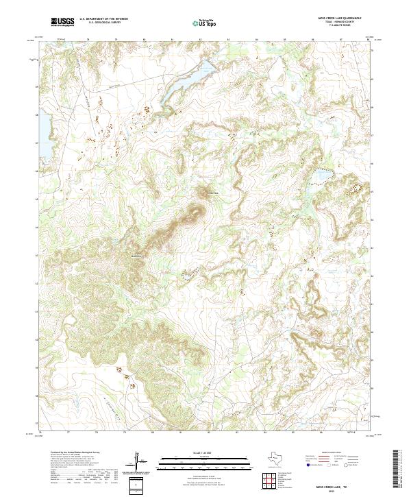
2022 Map of Moss Creek Lake
USGS Topo · Published 2022About this map
Moss Creek Lake serves as a central hydrological feature in this portion of Howard County, where the high desert terrain of West Texas is carved by a complex network of ephemeral draws and creeks. The landscape is dominated by the Signal Mountains, with Signal Peak rising as a prominent local landmark overlooking the surrounding plains. This drainage system includes Beals Cr to the north and numerous tributaries like Chimney Cr, Powell Cr, and Devils Cr that feed into the local basin.
Find a feature on this map
18 named features on this map. Tap any name to fly to it.
Don’t see what you’re looking for? This feature index may not catch every label — zoom into the map to look around manually.
Map Details
Editions of this 2022 Moss Creek Lake Map
This is the sole edition of this map. No revisions or reprints were ever made.
Other maps of this area

1941 · Big Spring South
USGS Topo · 1:62,500

1942 · Big Spring South
USGS Topo · 1:62,500

1942 · Big Spring North
USGS Topo · 1:62,500

1951 · Iatan
USGS Topo · 1:24,000

1952 · Iatan
USGS Topo · 1:24,000

1954 · Big Spring
USGS Topo · 1:250,000

1954 · Big Spring North
USGS Topo · 1:24,000

1958 · Big Spring
USGS Topo · 1:250,000

1963 · Hayrick Mountain
USGS Topo · 1:24,000
1963 · Hyman
USGS Topo · 1:24,000