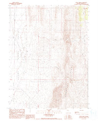
1990 Map of Moss Creek
USGS Topo · Published 1990About this map
Hot Springs and numerous thermal vents including Hot Sprs and Hot Spring define the western floor of the Reese River Valley in this late-twentieth-century study of Lander County. The landscape is dominated by the steep western slopes of the Shoshone Range, where drainage systems like Cottonwood Creek and Moss Creek flow toward the arid basin below. These ephemeral waterways illustrate the hydrology of the Great Basin, carving deep canyons such as Redrock Canyon before vanishing into the Smith Creek Flat. Evidence of ranching or rangeland management appears through isolated landmarks like a Water Tank, while the Reese River itself provides the primary north-south axis for the region. The map preserves the exact placement of these natural and developed water sources as they existed during the field checks of the late 1980s.
Find a feature on this map
15 named features on this map. Tap any name to fly to it.
Don’t see what you’re looking for? This feature index may not catch every label — zoom into the map to look around manually.
Map Details
Editions of this 1990 Moss Creek Map
This is the sole edition of this map. No revisions or reprints were ever made.
Other maps of this area

1932 · Sonoma Range
USGS Topo · 1:250,000

1939 · Sonoma Range
USGS Topo · 1:250,000

1949 · Mt. Lewis
USGS Topo · 1:62,500

1950 · Mt. Lewis
USGS Topo · 1:62,500

1955 · Winnemucca
USGS Topo · 1:250,000

1958 · Winnemucca
USGS Topo · 1:250,000

1961 · McCoy
USGS Topo · 1:62,500

1961 · The Cedars
USGS Topo · 1:62,500

1962 · Winnemucca
USGS Topo · 1:250,000

1962 · Carico Lake
USGS Topo · 1:62,500