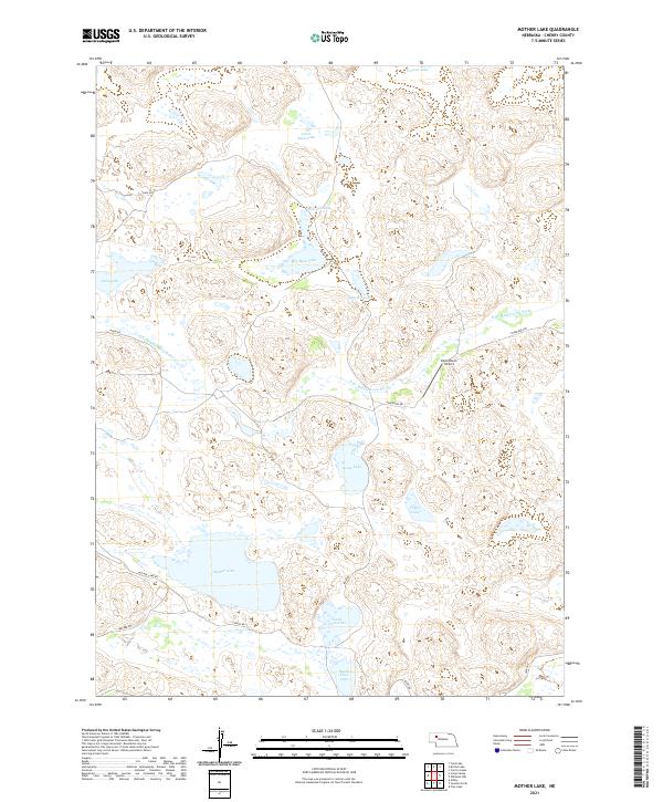
2021 Map of Mother Lake
USGS Topo · Published 2021About this map
Mother Lake and the winding course of the N Br Middle Loup River define this Nebraska Sandhills landscape in Cherry County. The area is characterized by a dense concentration of alkali and freshwater basins, including Goose Lake, Big Buck Lake, and the mirrored North Twin Lake and South Twin Lake. This 2021 survey shows a terrain dominated by these natural depressions and an sparse network of ranch roads such as Ponderosa Rd and Ashby Rd. The presence of the Davis Ranch Airport signifies the ongoing reliance on small-scale aviation for navigating this expansive ranching country. Other named water bodies like Slim Jim Lake and Solitaire Lake offer points of reference in a region where the natural hydrology dictates the layout of local infrastructure and land use.
Find a feature on this map
24 named features on this map. Tap any name to fly to it.
Don’t see what you’re looking for? This feature index may not catch every label — zoom into the map to look around manually.
Map Details
Editions of this 2021 Mother Lake Map
This is the sole edition of this map. No revisions or reprints were ever made.
Other maps of this area

1948 · Ashby
USGS Topo · 1:62,500

1948 · Whitman
USGS Topo · 1:62,500

1949 · Ashby
USGS Topo · 1:62,500

1949 · Steverson Lake
USGS Topo · 1:62,500

1949 · Turpin Lake
USGS Topo · 1:62,500

1950 · Whitman
USGS Topo · 1:62,500

1951 · Steverson Lake
USGS Topo · 1:62,500

1951 · Turpin Lake
USGS Topo · 1:62,500

1957 · Valentine
USGS Topo · 1:250,000

1959 · Valentine
USGS Topo · 1:250,000