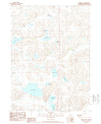
1989 Map of Mother Lake
USGS Topo · Published 1989About this map
The expansive Sandhills of Cherry County are defined here by a chain of water bodies and isolated livestock operations. Mother Lake serves as the central focal point of this hydrologic landscape, flanked by a series of smaller ponds including Goose Lake and the North Twin Lake and South Twin Lake pair. The topography consists of the characteristic undulating dunes of western Nebraska, where the only signs of permanent habitation are the scattered cattle ranches that anchor the local economy.
Find a feature on this map
20 named features on this map. Tap any name to fly to it.
Don’t see what you’re looking for? This feature index may not catch every label — zoom into the map to look around manually.
Map Details
Editions of this 1989 Mother Lake Map
This is the sole edition of this map. No revisions or reprints were ever made.
Other maps of this area

1948 · Ashby
USGS Topo · 1:62,500

1948 · Whitman
USGS Topo · 1:62,500

1949 · Ashby
USGS Topo · 1:62,500

1949 · Steverson Lake
USGS Topo · 1:62,500

1949 · Turpin Lake
USGS Topo · 1:62,500

1950 · Whitman
USGS Topo · 1:62,500

1951 · Steverson Lake
USGS Topo · 1:62,500

1951 · Turpin Lake
USGS Topo · 1:62,500

1957 · Valentine
USGS Topo · 1:250,000

1959 · Valentine
USGS Topo · 1:250,000