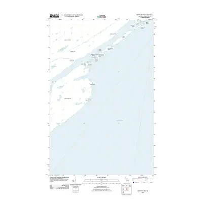
2011 Map of Mott Island
USGS Topo · Published 2011About this map
Rock Harbor Lighthouse stands as a sentinel over the complex island chains of Lake Superior in this 2011 survey of Michigan's northern reaches. The landscape is defined by the elongated ridges of Mount Ojibway and Mount Saginaw, which parallel the deep channels of Rock Harbor and Middle Passage. This topographical arrangement reflects the volcanic history of the region, where tilted rock layers create a sequence of sheltered bays like Conglomerate Bay and Tonkin Bay. Local history is preserved at Cemetery Island and West Caribou Island, while recreation is mapped at the Daisy Farm Campground and Threemile Campground. The proximity of Mine Point to the shoreline suggests the historical copper extraction efforts that once dominated this remote archipelago.
Find a feature on this map
39 named features on this map. Tap any name to fly to it.
Don’t see what you’re looking for? This feature index may not catch every label — zoom into the map to look around manually.
Map Details
Editions of this 2011 Mott Island Map
This is the sole edition of this map. No revisions or reprints were ever made.
Other maps of this area

1895 · Passage Island
USGS Topo · 1:62,500

1958 · Hancock
USGS Topo · 1:250,000

1959 · Fort William
USGS Topo · 1:250,000

1960 · Hancock
USGS Topo · 1:250,000

1961 · Hancock
USGS Topo · 1:250,000

1966 · Hancock
USGS Topo · 1:250,000

1968 · Fort William
USGS Topo · 1:250,000

1985 · Todd Harbor
USGS Topo · 1:100,000

1985 · Siskiwit Bay
USGS Topo · 1:100,000
1985 · Lake Richie
USGS Topo · 1:24,000