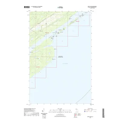
2019 Map of Mott Island
USGS Topo · Published 2019About this map
Greenstone Ridge forms the backbone of this archipelago within Isle Royale National Park, where the land meets the cold expanse of Lake Superior. The survey illustrates a complex network of narrow channels and secluded harbors, including Rock Harbor and the sheltered Moskey Basin. Along the eastern shore, a cluster of smaller landmasses like Cemetery Island, where a cemetery is noted, and the twin East Caribou Island and West Caribou Island protect the inner waters from the open lake.
Find a feature on this map
51 named features on this map. Tap any name to fly to it.
Don’t see what you’re looking for? This feature index may not catch every label — zoom into the map to look around manually.
Map Details
Editions of this 2019 Mott Island Map
This is the sole edition of this map. No revisions or reprints were ever made.
Other maps of this area

1895 · Passage Island
USGS Topo · 1:62,500

1958 · Hancock
USGS Topo · 1:250,000

1959 · Fort William
USGS Topo · 1:250,000

1960 · Hancock
USGS Topo · 1:250,000

1961 · Hancock
USGS Topo · 1:250,000

1966 · Hancock
USGS Topo · 1:250,000

1968 · Fort William
USGS Topo · 1:250,000

1985 · Todd Harbor
USGS Topo · 1:100,000

1985 · Siskiwit Bay
USGS Topo · 1:100,000
1985 · Lake Richie
USGS Topo · 1:24,000