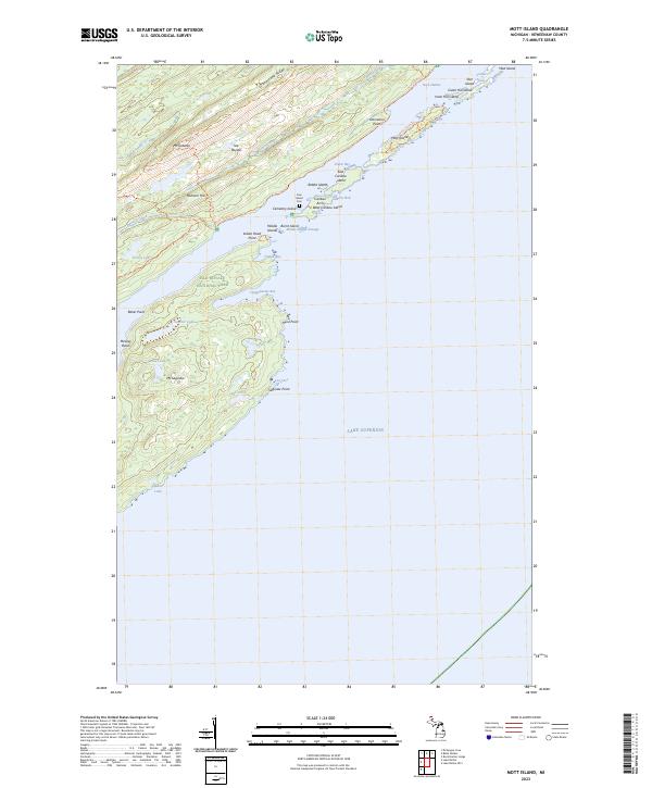
2023 Map of Mott Island
USGS Topo · Published 2023About this map
Greenstone Ridge forms the backbone of this archipelago within Isle Royale National Park, where a complex network of islands and narrow channels defines the Lake Superior shoreline. The map documents a wilderness landscape managed for conservation, featuring prominent elevations like Mt Ojibway and Mt Saginaw. Along the protected waters of Rock Harbor, small islands such as Mott Island and East Caribou Island cluster near the Middle Islands Passage. The presence of Cem Island and the Daisy Farm Trl suggests a history of human activity and early settlement patterns that predated the wilderness designation. From the depths of Moskey Basin to the landmark Caribou Arch, the map details a unique island geography shaped by prehistoric geology and modern preservation efforts.
Find a feature on this map
48 named features on this map. Tap any name to fly to it.
Don’t see what you’re looking for? This feature index may not catch every label — zoom into the map to look around manually.
Map Details
Editions of this 2023 Mott Island Map
This is the sole edition of this map. No revisions or reprints were ever made.
Other maps of this area

1895 · Passage Island
USGS Topo · 1:62,500

1958 · Hancock
USGS Topo · 1:250,000

1959 · Fort William
USGS Topo · 1:250,000

1960 · Hancock
USGS Topo · 1:250,000

1961 · Hancock
USGS Topo · 1:250,000

1966 · Hancock
USGS Topo · 1:250,000

1968 · Fort William
USGS Topo · 1:250,000

1985 · Todd Harbor
USGS Topo · 1:100,000

1985 · Siskiwit Bay
USGS Topo · 1:100,000
1985 · Lake Richie
USGS Topo · 1:24,000