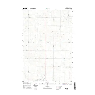
2014 Map of Mott North
USGS Topo · Published 2014About this map
Mott sits at the southern edge of this North Dakota landscape, where the Cannonball River winds through the prairie. This 2014 survey captures the agrarian grid of Hettinger County, defined by a series of sections roads from 64th St SW down to 72nd St SW. The terrain is shaped by the drainage systems of Spring Cr and Thirtymile Cr, which provide the primary topographic relief in an otherwise expansive plains environment. Local history and genealogy are anchored by the Slope Cem and the settlement at Sunny, located just east of the primary north-south corridor of ND-8. The map documents the precise intersection of natural watercourses and the human-imposed township and range system, showing the placement of farmsteads and rural infrastructure as they appeared in the early 21st century.
Find a feature on this map
19 named features on this map. Tap any name to fly to it.
Don’t see what you’re looking for? This feature index may not catch every label — zoom into the map to look around manually.
Map Details
Editions of this 2014 Mott North Map
This is the sole edition of this map. No revisions or reprints were ever made.
Other maps of this area

1953 · Dickinson
USGS Topo · 1:250,000

1957 · Dickinson
USGS Topo · 1:250,000

1960 · White Butte West
USGS Topo · 1:24,000

1960 · Clark Butte SW
USGS Topo · 1:24,000

1960 · White Butte East
USGS Topo · 1:24,000

1966 · Mott South
USGS Topo · 1:24,000

1966 · Mott NW
USGS Topo · 1:24,000

1966 · Mott SW
USGS Topo · 1:24,000

1966 · Mott North
USGS Topo · 1:24,000

1969 · Burt
USGS Topo · 1:24,000