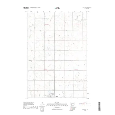
2018 Map of Mott North
USGS Topo · Published 2018About this map
Mott sits at the southern edge of this Hettinger County landscape, where the prairie is defined by a systematic grid of section lines and watercourses. This map reveals the northern outskirts of the community, documented just as modern agriculture and traditional homesteading patterns continue to shape the region. The drainage of Spring Cr wanders across the western and central sections, while Thirtymile Cr carves through the northeast, reflecting the importance of natural irrigation in this open environment. Local heritage is concentrated near the town site at the Saint Vincents Catholic Cem and Mott Sunny Slope Cem, which serve as vital touchstones for family historians and genealogists tracking the area's early settlers. The road network, including Larson Lake Rd and Van Lishout Rd, follows the rigid township-and-range lines that have organized the North Dakota horizon for generations.
Find a feature on this map
24 named features on this map. Tap any name to fly to it.
Don’t see what you’re looking for? This feature index may not catch every label — zoom into the map to look around manually.
Map Details
Editions of this 2018 Mott North Map
This is the sole edition of this map. No revisions or reprints were ever made.
Other maps of this area

1953 · Dickinson
USGS Topo · 1:250,000

1957 · Dickinson
USGS Topo · 1:250,000

1960 · White Butte West
USGS Topo · 1:24,000

1960 · Clark Butte SW
USGS Topo · 1:24,000

1960 · White Butte East
USGS Topo · 1:24,000

1966 · Mott South
USGS Topo · 1:24,000

1966 · Mott NW
USGS Topo · 1:24,000

1966 · Mott SW
USGS Topo · 1:24,000

1966 · Mott North
USGS Topo · 1:24,000

1969 · Burt
USGS Topo · 1:24,000