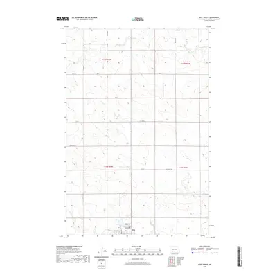
2020 Map of Mott North
USGS Topo · Published 2020About this map
The town of Mott sits at the southern edge of this North Dakota landscape, serving as a hub for the surrounding agricultural plains of Hettinger County. The local topography is defined by the winding course of Spring Cr, which meanders across the northern and central sections before nearing the town site. For genealogists and local historians, the presence of Mott-Sunny Slope Cem and Saint Vincents Catholic Cem on the northern outskirts of the settlement provides specific points of interest for family research. The map illustrates a strictly organized grid of rural roads, including Larson Lake Rd and Van Lishout Rd, which partition the prairie into sections for farming. This layout reflects the enduring influence of the Public Land Survey System, with township lines like t135n r93w and t134n r93w clearly demarcating the open territory north of the Cannonball River valley.
Find a feature on this map
24 named features on this map. Tap any name to fly to it.
Don’t see what you’re looking for? This feature index may not catch every label — zoom into the map to look around manually.
Map Details
Editions of this 2020 Mott North Map
This is the sole edition of this map. No revisions or reprints were ever made.
Other maps of this area

1953 · Dickinson
USGS Topo · 1:250,000

1957 · Dickinson
USGS Topo · 1:250,000

1960 · White Butte West
USGS Topo · 1:24,000

1960 · Clark Butte SW
USGS Topo · 1:24,000

1960 · White Butte East
USGS Topo · 1:24,000

1966 · Mott South
USGS Topo · 1:24,000

1966 · Mott NW
USGS Topo · 1:24,000

1966 · Mott SW
USGS Topo · 1:24,000

1966 · Mott North
USGS Topo · 1:24,000

1969 · Burt
USGS Topo · 1:24,000