
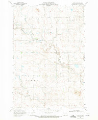
1966 Map of Mott North
USGS Topo · Published 1967About this map
The Cannonball River defines the southern edge of this landscape, where the town of Mott serves as a regional hub for the surrounding plains of Hettinger County. This mid-1960s survey captures the intersection of water and rail as the Chicago Milwaukee St Paul and Pacific railroad tracks parallel the river's course. North of the town center, the terrain is shaped by the winding paths of Spring Creek and Thirty-mile Creek, carving through the high ground designated by local township or family names like Acme, Steiner, and Beery.
Find a feature on this map
15 named features on this map. Tap any name to fly to it.
Don’t see what you’re looking for? This feature index may not catch every label — zoom into the map to look around manually.
Map Details
Editions of this 1966 Mott North Map
This is the sole edition of this map. No revisions or reprints were ever made.
Other maps of this area

1953 · Dickinson
USGS Topo · 1:250,000

1957 · Dickinson
USGS Topo · 1:250,000

1960 · White Butte West
USGS Topo · 1:24,000

1960 · Clark Butte SW
USGS Topo · 1:24,000

1960 · White Butte East
USGS Topo · 1:24,000

1966 · Mott South
USGS Topo · 1:24,000

1966 · Mott NW
USGS Topo · 1:24,000

1966 · Mott SW
USGS Topo · 1:24,000

1969 · Burt
USGS Topo · 1:24,000
1969 · Burt NW
USGS Topo · 1:24,000