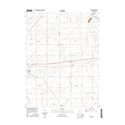
2016 Map of Moulton
USGS Topo · Published 2016About this map
The Auglaize River and Saint Marys River define the hydraulic character of this western Ohio landscape, where the settlements of Buckland, Glynwood, and Moulton serve as anchors for a grid of section lines and township roads. This area of Auglaize County retains a strong agricultural and commemorative footprint, evidenced by several small burial grounds such as Saint Thomas Cem, Zion Cem, and Arnett Cem. A legacy of the historic canal era is quietly preserved in names like Lock 14 Rd, while modern outdoor recreation is represented by the N Country National Scenic Trail (Buckeye Trail) which winds through the western portion of the quadrangle near the edge of Saint Marys. Numerous small waterways, including Sims Run, Sixmile Cr, and Clear Cr, weave between the farmsteads, following the subtle elevation changes of the till plains.
Find a feature on this map
120 named features on this map. Tap any name to fly to it.
Don’t see what you’re looking for? This feature index may not catch every label — zoom into the map to look around manually.
Map Details
Editions of this 2016 Moulton Map
This is the sole edition of this map. No revisions or reprints were ever made.
Other maps of this area

1906 · Lima
USGS Topo · 1:62,500

1909 · Loramie
USGS Topo · 1:62,500

1911 · Loramie
USGS Topo · 1:62,500

1911 · Spencerville
USGS Topo · 1:62,500

1913 · Sidney
USGS Topo · 1:62,500

1944 · Sidney
USGS Topo · 1:62,500

1944 · Loramie
USGS Topo · 1:62,500

1944 · Spencerville
USGS Topo · 1:62,500

1953 · Muncie
USGS Topo · 1:250,000

1956 · Muncie
USGS Topo · 1:250,000