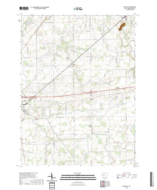
2023 Map of Moulton
USGS Topo · Published 2023About this map
St. Marys and the surrounding Auglaize County farmland are defined by a complex network of waterways and historic rural settlements. The Auglaize River winds through the northeast corner near Buckland, while the Saint Marys River and its various tributaries, including the East Branch, Center Branch, and Muddy Creek, drain the western and southern reaches. Small communities like Glynwood and Moulton serve as anchors for the agricultural landscape, which is partitioned by a precise grid of township and county roads. For those tracking local history or genealogy, the map identifies several local burial grounds, including Saint Thomas Cem, Arnett Cem, and Zion Cem. A notable modern feature is the North Country National Scenic Trl, which traverses the western edge of the quadrangle, following the path of older transport corridors near the Saint Marys River and Ankerman Creek.
Find a feature on this map
83 named features on this map. Tap any name to fly to it.
Don’t see what you’re looking for? This feature index may not catch every label — zoom into the map to look around manually.
Map Details
Editions of this 2023 Moulton Map
This is the sole edition of this map. No revisions or reprints were ever made.
Other maps of this area

1906 · Lima
USGS Topo · 1:62,500

1909 · Loramie
USGS Topo · 1:62,500

1911 · Loramie
USGS Topo · 1:62,500

1911 · Spencerville
USGS Topo · 1:62,500

1913 · Sidney
USGS Topo · 1:62,500

1944 · Sidney
USGS Topo · 1:62,500

1944 · Loramie
USGS Topo · 1:62,500

1944 · Spencerville
USGS Topo · 1:62,500

1953 · Muncie
USGS Topo · 1:250,000

1956 · Muncie
USGS Topo · 1:250,000