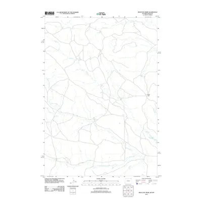
2012 Map of Moulton Creek
USGS Topo · Published 2012About this map
N Fork Little Missouri River and its various tributaries define this section of Carter County, Montana, as it appeared in the early 21st century. The landscape is characterized by a dense network of watercourses, including Moulton Cr, Battle Cr, and the Gammon Prong, which carve through the high plains near the Wyoming border. This 2012 survey illustrates a sparsely populated ranching environment where the most significant landmarks are hydrological features and topographical points like Signal Hill. The presence of the Battle Creek Reservoir in the southeastern quadrant suggests local water management essential for livestock or agriculture in this arid region. The intricate web of local roads and 4WD tracks shown here indicates a remote area where transportation is closely tied to the natural drainage patterns of the Little Missouri watershed.
Find a feature on this map
10 named features on this map. Tap any name to fly to it.
Don’t see what you’re looking for? This feature index may not catch every label — zoom into the map to look around manually.
Map Details
Editions of this 2012 Moulton Creek Map
This is the sole edition of this map. No revisions or reprints were ever made.
Other maps of this area

1905 · Devils Tower
USGS Topo · 1:125,000

1954 · Ekalaka
USGS Topo · 1:250,000

1954 · Gillette
USGS Topo · 1:250,000

1955 · Gillette
USGS Topo · 1:250,000

1956 · Ekalaka
USGS Topo · 1:250,000

1957 · Cedar Ridge
USGS Topo · 1:62,500

1958 · Gillette
USGS Topo · 1:250,000

1958 · Ekalaka
USGS Topo · 1:250,000

1962 · Gillette
USGS Topo · 1:250,000

1965 · Ekalaka
USGS Topo · 1:250,000