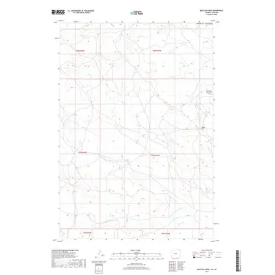
2017 Map of Moulton Creek
USGS Topo · Published 2017About this map
The N Fork Little Missouri River flows through this corner of Montana, anchoring a landscape defined by an intricate network of drainages and ranching terrain. In the eastern portion of the quadrangle, the Thompson Creek Oilfield Airport serves as a lone infrastructure hub near Signal Hill, reflecting the intersection of light aviation and local industry. The map illustrates a high density of intermittent watercourses, including Gammon Prong, N Gammon Prong, and Driscoll Cr, which carve through the land before crossing the southern border. In the northern reaches, Moulton Cr and Battle Cr dominate the drainage pattern. A small pocket of water storage is visible at the Battle Cr Reservoir, a critical resource in this arid stretch of Crook County, Wyoming and Montana borderland.
Find a feature on this map
17 named features on this map. Tap any name to fly to it.
Don’t see what you’re looking for? This feature index may not catch every label — zoom into the map to look around manually.
Map Details
Editions of this 2017 Moulton Creek Map
This is the sole edition of this map. No revisions or reprints were ever made.
Other maps of this area

1905 · Devils Tower
USGS Topo · 1:125,000

1954 · Ekalaka
USGS Topo · 1:250,000

1954 · Gillette
USGS Topo · 1:250,000

1955 · Gillette
USGS Topo · 1:250,000

1956 · Ekalaka
USGS Topo · 1:250,000

1957 · Cedar Ridge
USGS Topo · 1:62,500

1958 · Gillette
USGS Topo · 1:250,000

1958 · Ekalaka
USGS Topo · 1:250,000

1962 · Gillette
USGS Topo · 1:250,000

1965 · Ekalaka
USGS Topo · 1:250,000