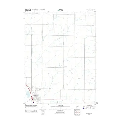
2012 Map of Mound City
USGS Topo · Published 2012About this map
Mound City sits in the southwestern corner of this Northwest Missouri landscape, where the Missouri River floodplain meets the uplands. The drainage patterns of Squaw Creek and its tributaries, including Middle Branch and East Branch, dominate the northern topography. To the east and south, Davis Creek and the channelized Davis Creek Ditch define the agricultural water management of Holt County. For genealogists and local historians, the map identifies two significant burial grounds: Mount Hope Cemetery just north of the city limits and Center District Cemetery further inland. The rural infrastructure is detailed through a dense grid of county roads and distinctive landmarks like the Hall Landing Strip, reflecting the aviation and transport needs of this farming community in the early twenty-first century.
Find a feature on this map
53 named features on this map. Tap any name to fly to it.
Don’t see what you’re looking for? This feature index may not catch every label — zoom into the map to look around manually.
Map Details
Editions of this 2012 Mound City Map
This is the sole edition of this map. No revisions or reprints were ever made.
Other maps of this area

1920 · Craig
USGS Topo · 1:62,500

1926 · Maitland
USGS Topo · 1:62,500

1939 · Tarkio
USGS Topo · 1:62,500

1939 · Skidmore
USGS Topo · 1:62,500

1940 · Tarkio
USGS Topo · 1:62,500

1941 · Tarkio
USGS Topo · 1:62,500

1941 · Skidmore
USGS Topo · 1:62,500

1942 · Skidmore
USGS Topo · 1:62,500

1955 · Nebraska City
USGS Topo · 1:250,000

1957 · Nebraska City
USGS Topo · 1:250,000