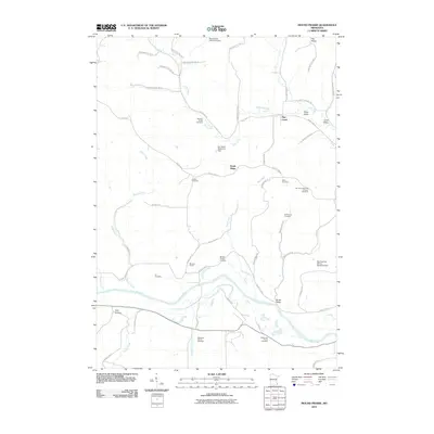
2010 Map of Mound Prairie
USGS Topo · Published 2010About this map
Mound Prairie and South Ridge anchor a landscape defined by the convergence of the Root River and its numerous tributaries in southeastern Minnesota. This late 20th and early 21st-century terrain is marked by deep coulees and ridges, including Pea Ridge and Chicken Ridge Road. The area's genealogical depth is evident in the high density of family and denominational burial grounds, ranging from the Immanuel German Lutheran Cemetery to smaller family plots like the Sheldon Family Cemetery and Ruff Family Cemetery.
Find a feature on this map
54 named features on this map. Tap any name to fly to it.
Don’t see what you’re looking for? This feature index may not catch every label — zoom into the map to look around manually.
Map Details
Editions of this 2010 Mound Prairie Map
This is the sole edition of this map. No revisions or reprints were ever made.
Other maps of this area

1930 · La Crescent
USGS Topo · 1:62,500

1956 · Brownsville
USGS Topo · 1:62,500

1956 · La Crescent
USGS Topo · 1:62,500

1958 · Houston
USGS Topo · 1:62,500

1958 · La Crosse
USGS Topo · 1:250,000

1961 · La Crosse
USGS Topo · 1:250,000

1965 · La Crosse
USGS Topo · 1:250,000

1965 · Sheldon
USGS Topo · 1:24,000
1973 · Pickwick
USGS Topo · 1:24,000
1973 · Mound Prairie
USGS Topo · 1:24,000