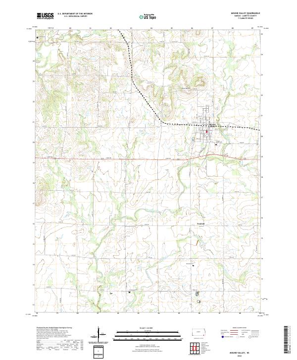
2022 Map of Mound Valley
USGS Topo · Published 2022About this map
Mound Valley serves as the central hub of this Labette County landscape, where a traditional grid of streets like Pine St and Hickory St meets the winding path of Pumpkin Creek. The settlement pattern is defined by rural crossroads and the legacy of local families, evidenced by the distribution of four distinct burial grounds: Mound Valley Cem, Penfield Cem, Richland Cem, and Griffith Cem. These sites, often located near watercourses such as Richland Creek and Wildcat Cr, suggest the early nodes of community life in this part of Kansas.
Find a feature on this map
61 named features on this map. Tap any name to fly to it.
Don’t see what you’re looking for? This feature index may not catch every label — zoom into the map to look around manually.
Map Details
Editions of this 2022 Mound Valley Map
This is the sole edition of this map. No revisions or reprints were ever made.
Other maps of this area

1886 · Independence
USGS Topo · 1:125,000

1886 · Parsons
USGS Topo · 1:125,000

1893 · Parsons
USGS Topo · 1:125,000

1894 · Independence
USGS Topo · 1:125,000

1905 · Independence
USGS Topo · 1:125,000

1945 · Parsons
USGS Topo · 1:62,500

1946 · Parsons
USGS Topo · 1:62,500

1946 · Mound Valley
USGS Topo · 1:62,500

1947 · Parsons
USGS Topo · 1:62,500

1947 · Joplin
USGS Topo · 1:250,000