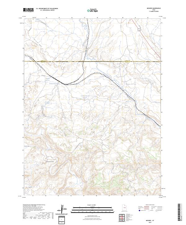
2023 Map of Mounds
USGS Topo · Published 2023About this map
The Price River winds through this arid expanse of east-central Utah, carving a path through the geological formations of the Mounds Reef and Church Flats. This 2023 survey illustrates a landscape heavily defined by water management and transit, where the Carbon and Emery county line bisects a series of catchment features including Spider Reservoir, Goodwater Reservoir, and the Southeast Mounds Reservoir.
Find a feature on this map
17 named features on this map. Tap any name to fly to it.
Don’t see what you’re looking for? This feature index may not catch every label — zoom into the map to look around manually.
Map Details
Editions of this 2023 Mounds Map
This is the sole edition of this map. No revisions or reprints were ever made.
Other maps of this area

1886 · Price River
USGS Topo · 1:250,000

1896 · Price River
USGS Topo · 1:250,000

1915 · Sunnyside
USGS Topo · 1:62,500

1915 · Wellington
USGS Topo · 1:62,500

1948 · Woodside
USGS Topo · 1:62,500

1949 · Woodside
USGS Topo · 1:62,500

1950 · Woodside
USGS Topo · 1:62,500

1956 · Price
USGS Topo · 1:250,000

1960 · Price
USGS Topo · 1:250,000

1962 · Price
USGS Topo · 1:250,000