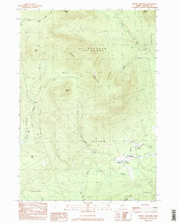
1984 Map of Mount Abraham
USGS Topo · Published 1985About this map
Mount Abraham and the surrounding highlands of Franklin County dominate this 1984 survey, which documents a landscape defined by timber, high-elevation hiking, and small valley settlements. The Appalachian National Scenic Trail traverses the northern ridges near Spalding Mtn, while further south, the West Branch Carrabassett River provides the primary drainage for the village of Salem.
Find a feature on this map
28 named features on this map. Tap any name to fly to it.
Don’t see what you’re looking for? This feature index may not catch every label — zoom into the map to look around manually.
Map Details
Editions of this 1984 Mount Abraham Map
2 editions found
Other maps of this area

1928 · Dead River
USGS Topo · 1:62,500

1928 · Stratton
USGS Topo · 1:48,000

1929 · Phillips
USGS Topo · 1:48,000

1930 · Kingfield
USGS Topo · 1:48,000

1931 · Dead River
USGS Topo · 1:48,000

1932 · Phillips
USGS Topo · 1:62,500

1932 · Stratton
USGS Topo · 1:62,500

1932 · Kingfield
USGS Topo · 1:62,500

1944 · Dead River
USGS Topo · 1:62,500

1949 · Jackman
USGS Topo · 1:250,000